CARICOOS is the Caribbean Coastal Ocean Observing System
Instrumentation
What is an ocean observation system?
An ocean observing system is a network that combines technologies, instruments, and human resources in order to collect data that will help monitor current ocean conditions and improve forecasts. Each ocean observation system has its particula
rities and is designed and adapted for its respective environment.
Its components vary according to the information you intend to collect and the users you want to reach. The components of an ocean observation system include, but are not limited to, oceanographic buoys, weather stations, radars, satellite
resources, and underwater gliders (sea gliders), among others.
The following describes some of the instruments and platforms that are part of the Caribbean Coastal Ocean Observing System (CARICOOS)
Instrumentation
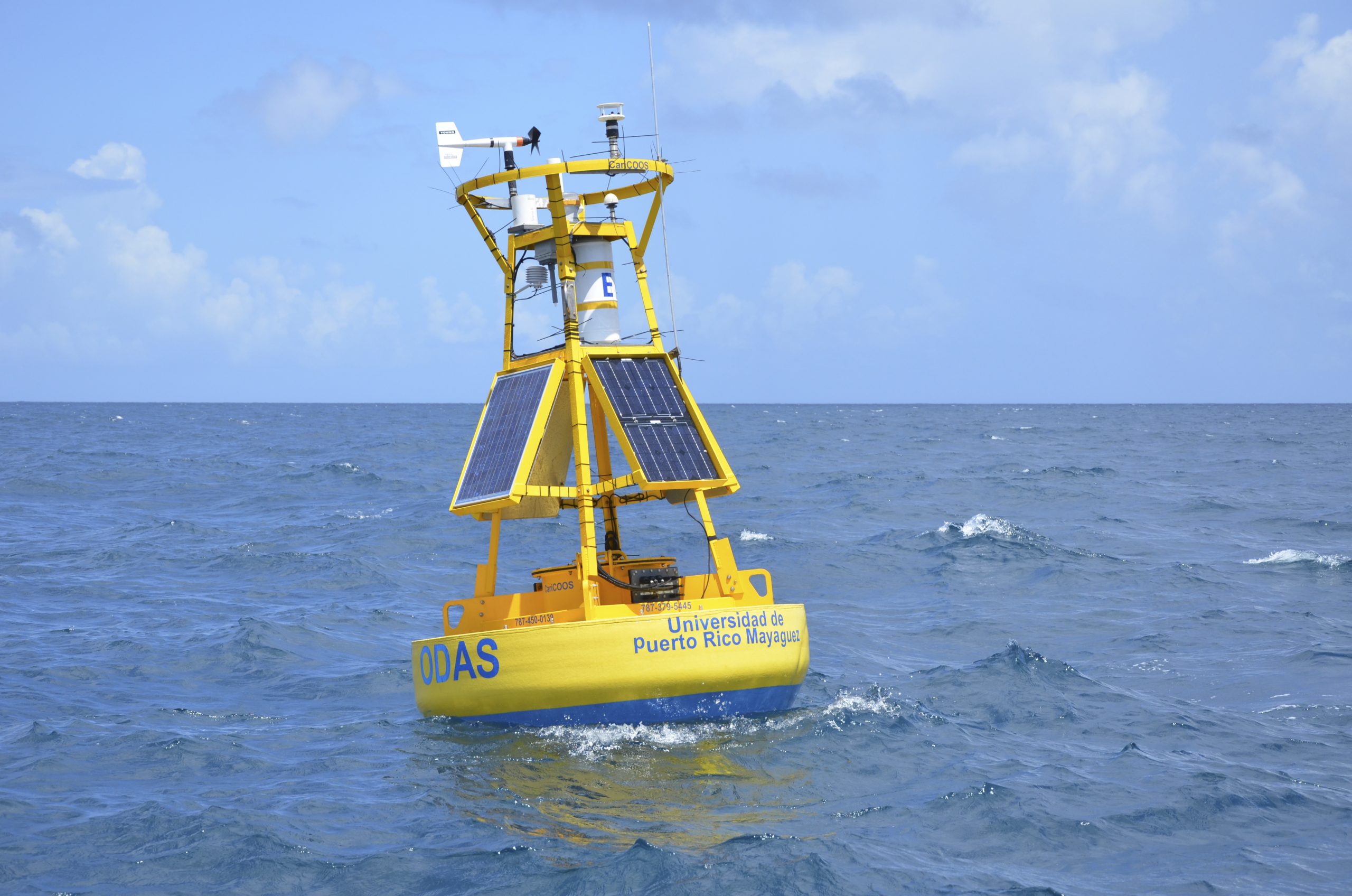
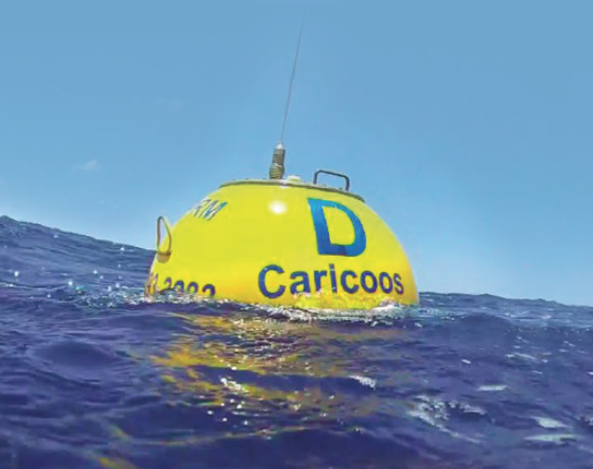
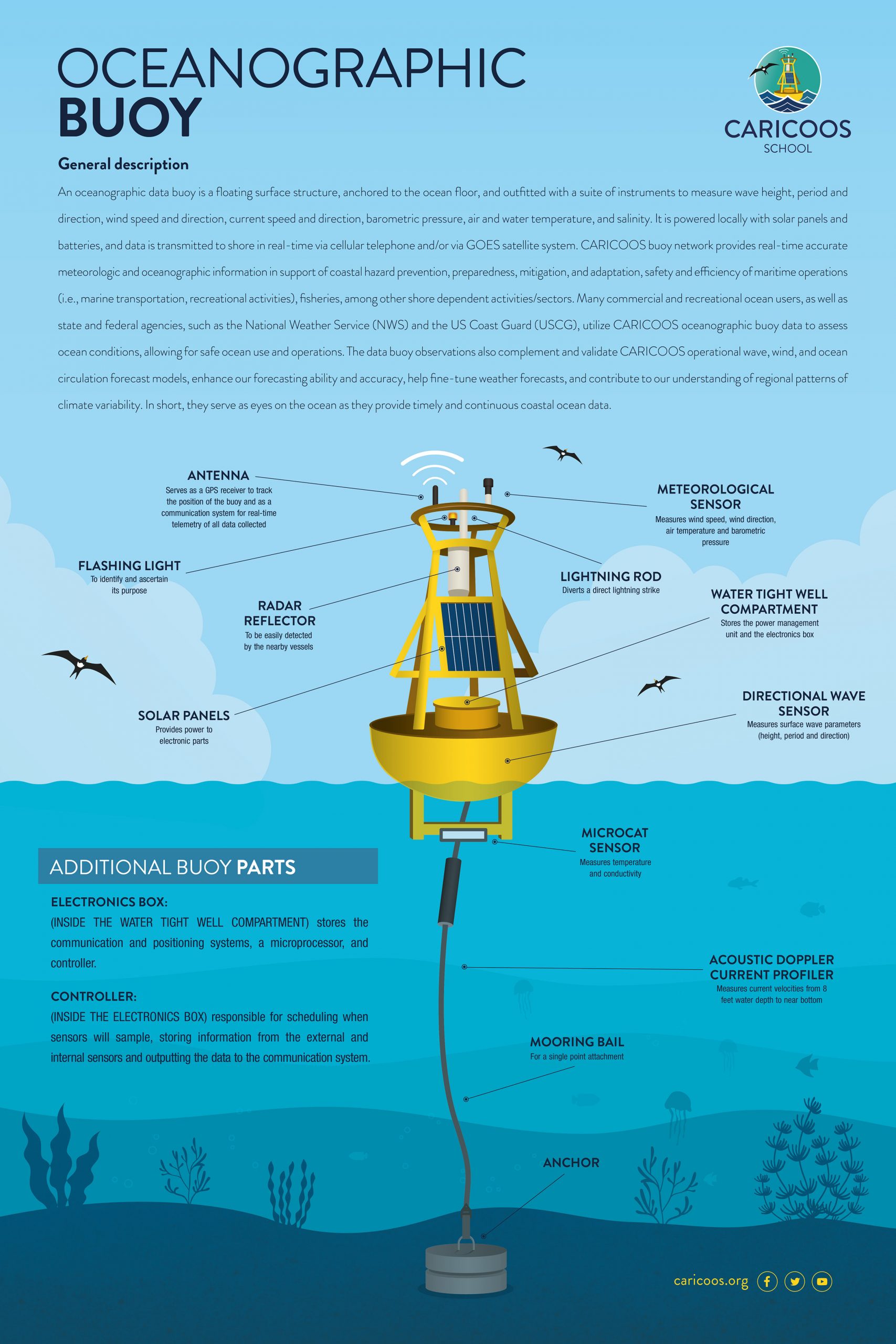
Oceanographic Buoys
They are floating structures anchored to the seabed that have devices to obtain oceanographic and meteorological data in real time. Some of these instruments are: anemometers (measuring wind), solar panels (providing energy), and accelerometers (measuring wave height). Once the data is collected, via satellite transmission data is stored for modeling, forecasting and other scientific purposes. The data collected by the buoys are published on the CARICOOS website
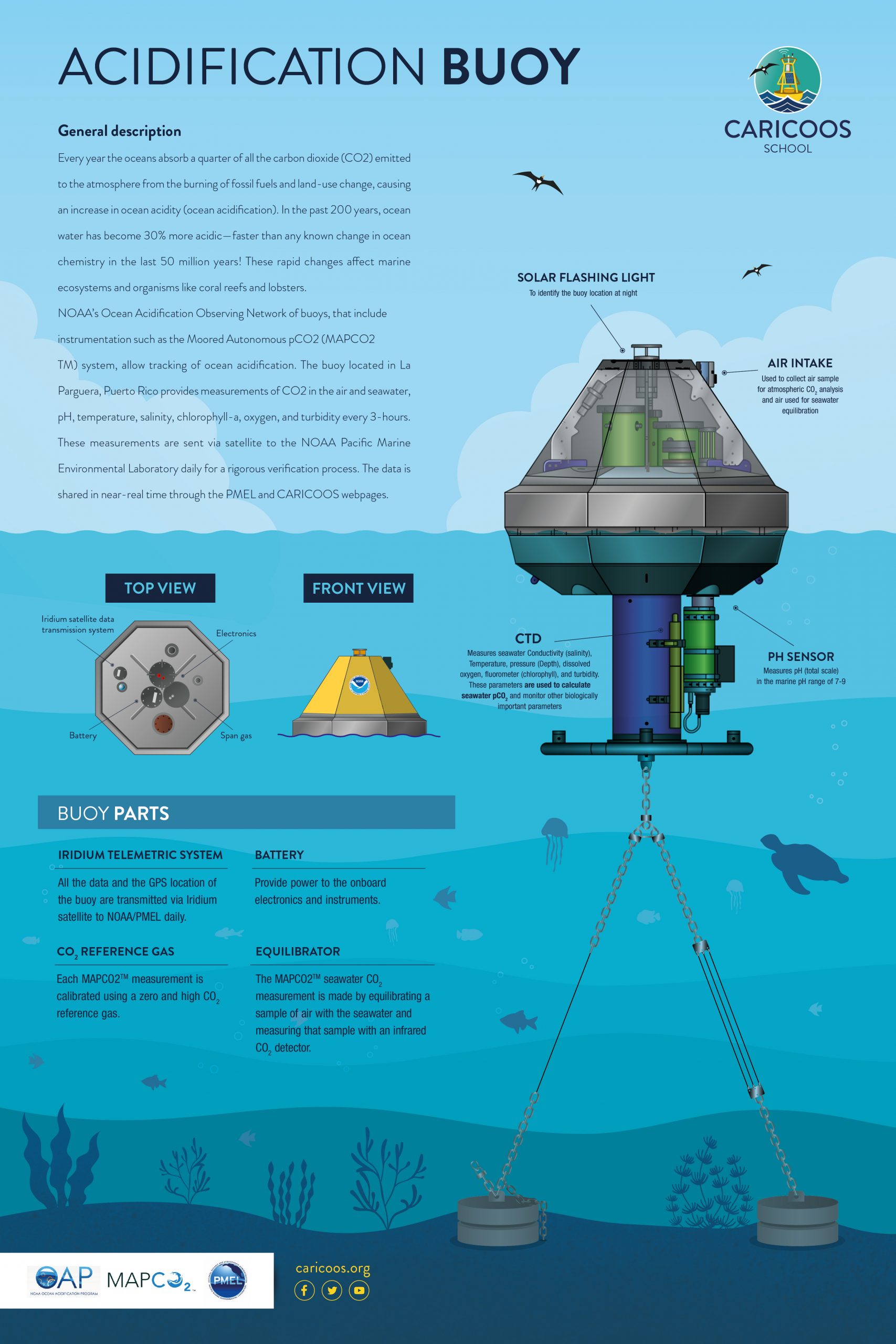
Ocean Acidification Monitoring Buoy
The ocean acidification monitoring buoy operated by CARICOOS records real-time data of atmospheric and oceanic carbon dioxide. It provides measurements of CO2 in air and seawater, pH, temperature, salinity, chlorophyll-a, oxygen and turbidity every three hours. These measurements are sent daily via satellite to NOAA's Pacific Marine Environmental Laboratory for a rigorous verification process. Once analyzed and refined, the data is shared through the PMEL and CARICOOS web pages. The data collected by the acidification buoy is of great value to resource managers. The bouy allows small acidity changes in the sea to be documented and eventually used to examine how these changes may adversely affect marine organisms and their ecosystems.
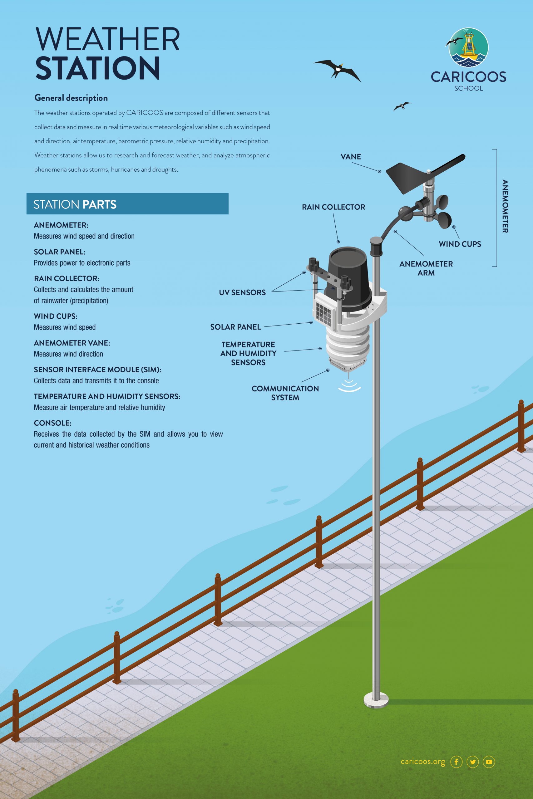
Weather Stations
They are a set of instruments installed in a marine or terrestrial space and whose purpose is to collect real-time data on wind speed and direction, air temperature, relative humidity, barometric pressure, among other parameters of the atmosphere. The data collected by these instruments provide important information about weather conditions.
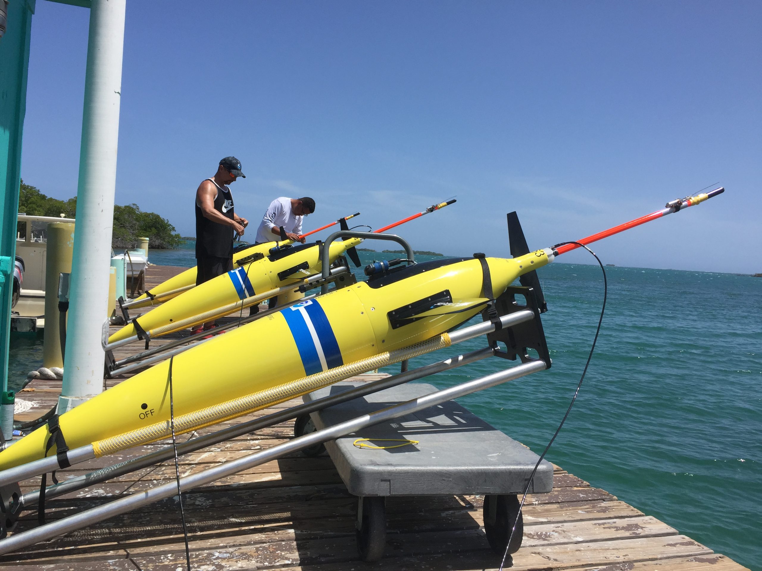
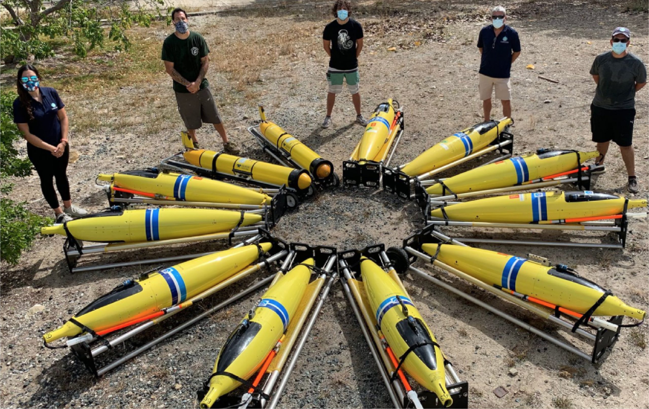
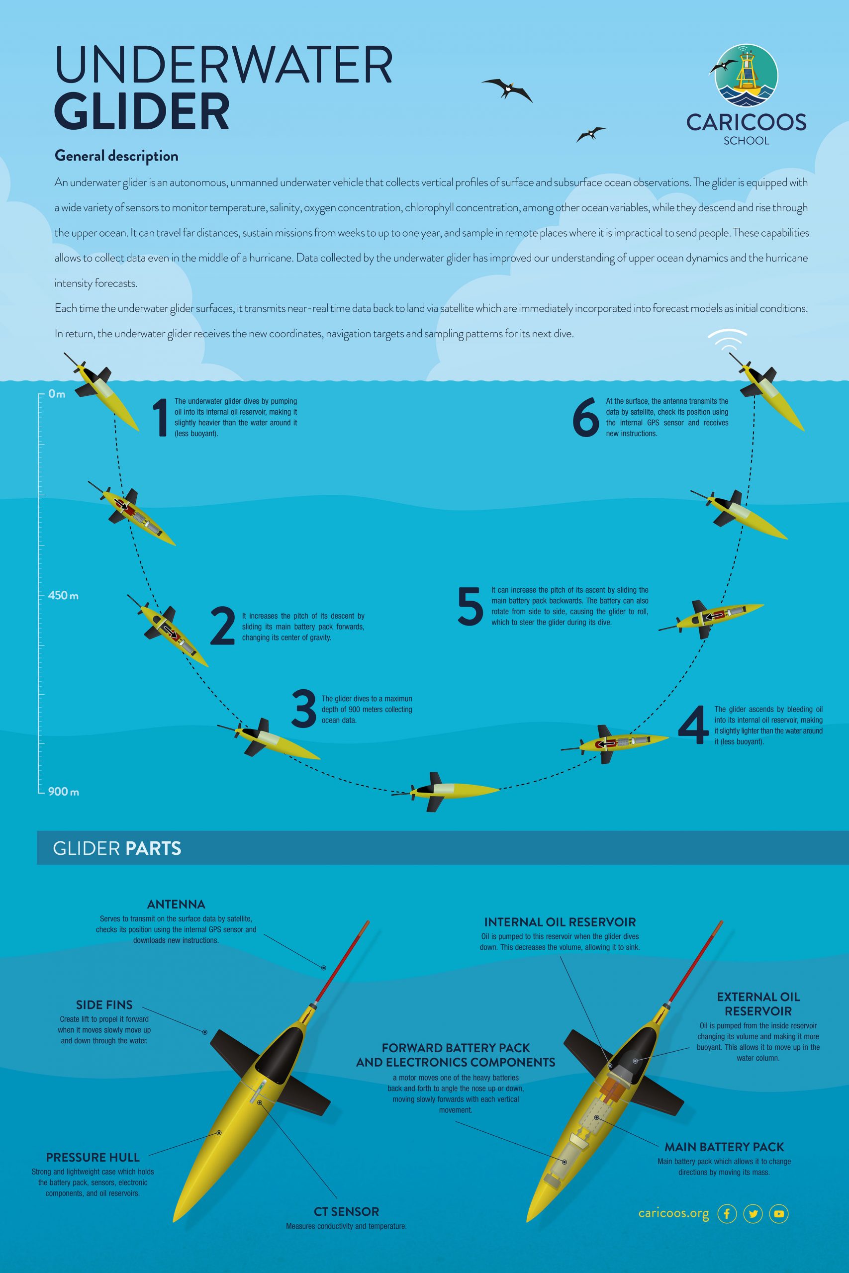
SeaGlider (Underwater Glider)
Underwater gliders are autonomous, unmanned underwater vehicles that collect vertical profiles of surface and subsurface ocean observations. As part of their missions, gliders dive until they reach half a mile deep and then ascend to the surface of the sea. During this process of descent and ascent, the glider collects thousands of observations of the vertical salinity and temperature profile of the water. Once the glider reaches the surface, it transmits the data via satellite so it can be stored and eventually used to improve hurricane intensity forecasts.
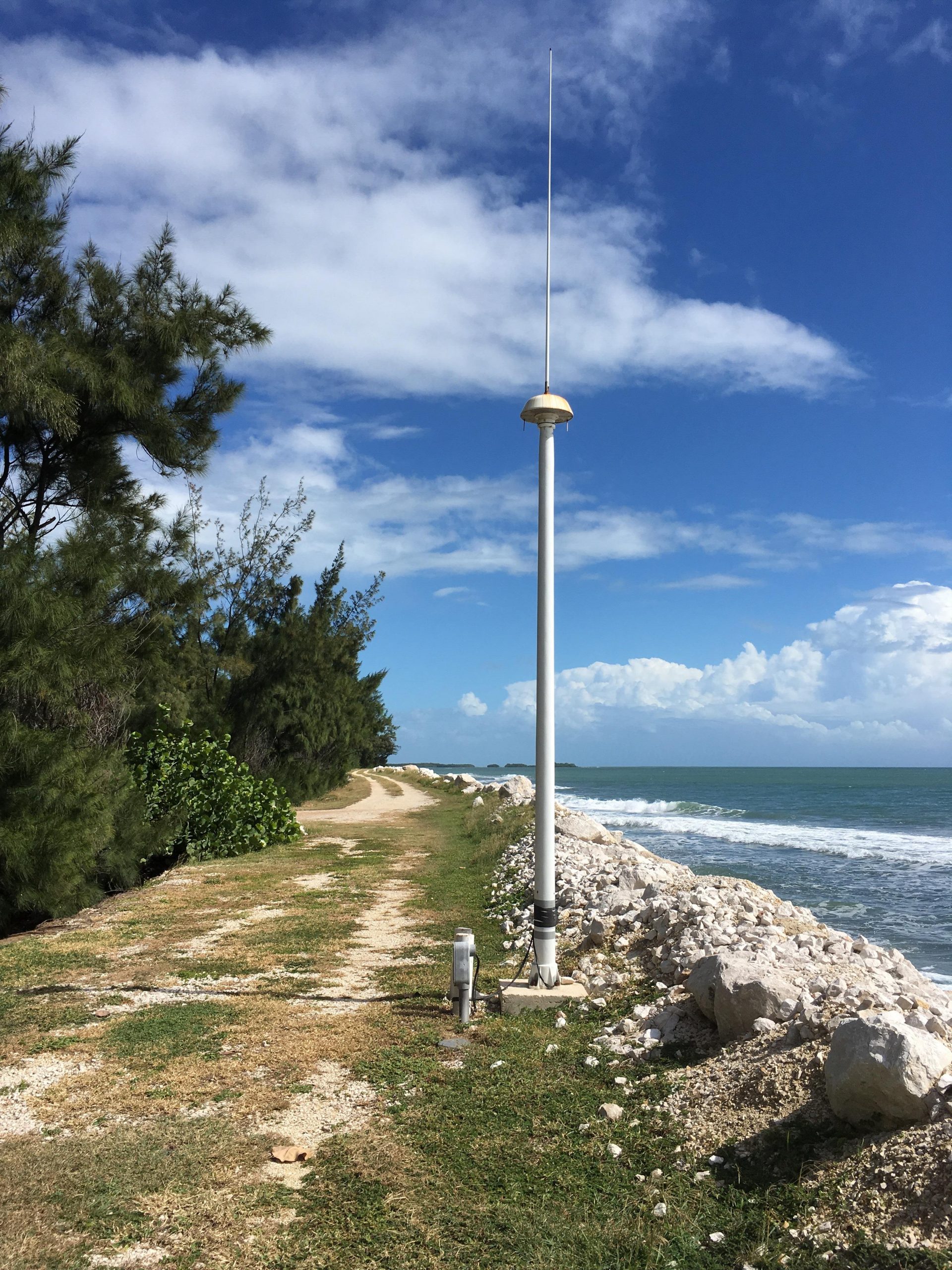
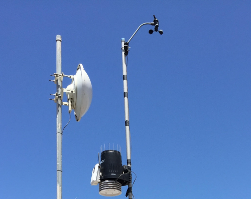
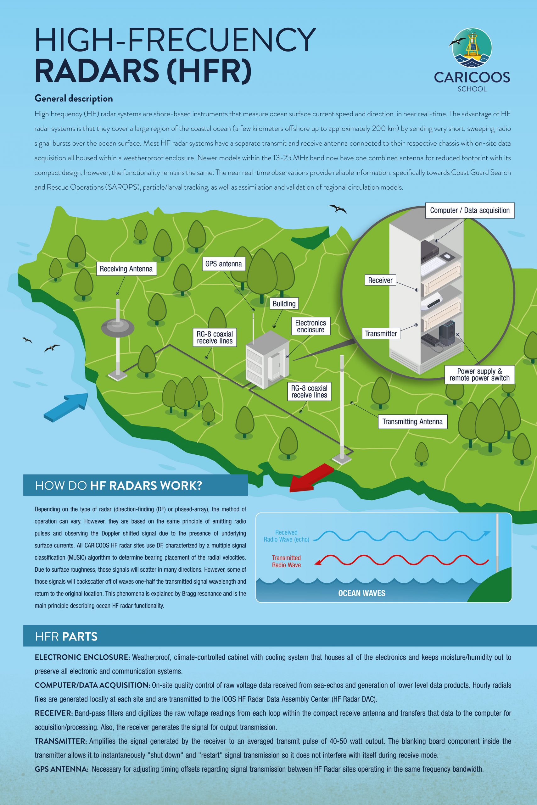
High frequency radar
High frequency radars (HFRs) are very useful tools for measuring the speed and direction of surface currents in the sea. Although there are different types of HFR, they are all based on the same principle of emitting radio pulses and observing how the displacement and return of the signal occurs. Due to surface roughness, those signals will scatter in many directions. However, some of those signals will backscatter off of waves one-half the transmitted signal wavelength and return to original location. For this, the system integrates a series of instruments, such as antennas (transmitter and receiver) and receivers installed in coastal areas on the main land. The data generated by the HFR allow surface currents maps to be developed. These maps provide very important information for search and rescue operations at sea and to anticipate the possible route of oil spills or other hazardous materials.
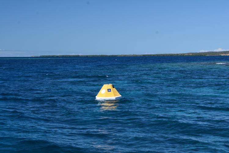
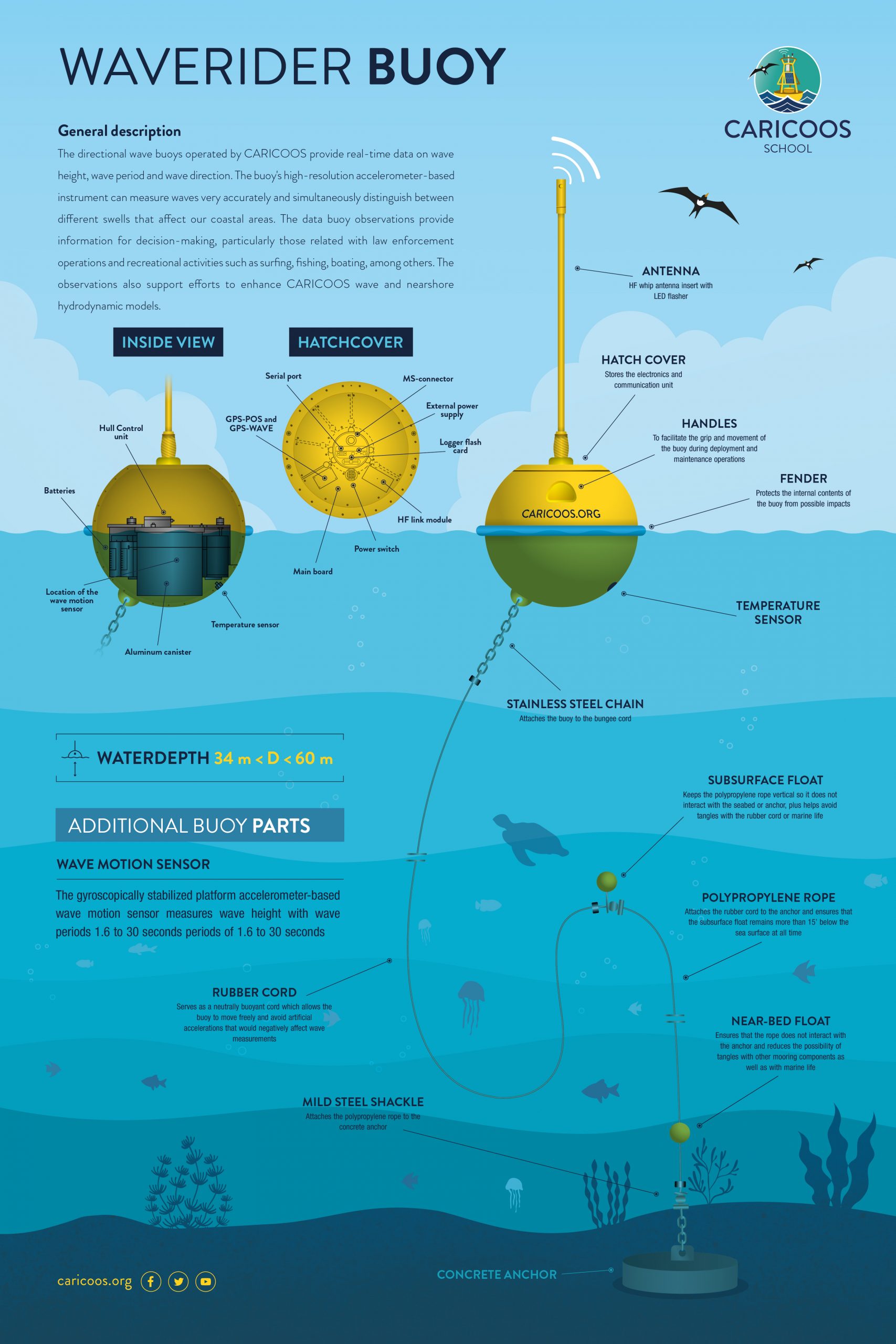
Wave buoys
The directional wave buoys operated by CARICOOS provide real-time data on wave height, wave period and wave direction. The buoy's high- resolution accelerometer-based instrument can measure waves very accurately and simultaneously distinguish between different types of swells that affect our coastal areas. The data buoy observations provide information for decision-making, particularly those related with law enforcement operations and recreational activities such as surfing, fishing, boating, among others. The observations also support efforts to enhance CARICOOS wave and nearshore hydrodynamic models.
The CARICOOS education and outreach staff is dedicated to developing various educational activities so that the public can understand and interpret the information.
+ Info